
Return to Northumberland and Borders Maps Index Page
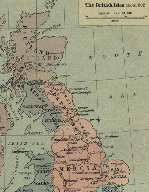
The Northumberland and Borders region of the United Kingdom ca. 802 AD showing the kingdom of Northumbria and neighbouring realms (taken from map of William Shepherd).
Link to high resolution pop-up version of map (556 kb; 650 X 854 pixels; 72 dpi)