Return to Northumberland and Borders Maps Index Page
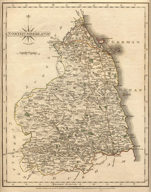
Detailed physical geography map of Northumberland showing communities, highways and topography. London: Published as the Art directs, September 1st, 1787 by J. Cary, Engraverl Map & Printseller No. 188 the corner of Arundel Street Strand.
Link to high resolution pop-up version of map (1349 kb; 2038 X 2581 pixels; 72 dpi)