History Historical Items/Documents Gallery Maps
Return to Northumberland and Borders Maps Index Page
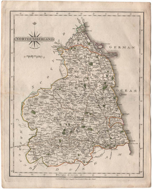
Detailed physical geography map of Northumberland showing communities, highways and topography. London: Published Jan. 1st, 1793 by J. Cary, Engraver & Mapseller Strand.
Link to high resolution pop-up version of map (431 kb; 1280 X 1588 pixels; 72 dpi)